** NOTE: This article was written in 2016, and may contain out-of-date information **
Going for a hike requires planning whether its a few hours, a few days or a few months. Of course, if you’re hiking the Rideau Trail, you’ll need our maps which you can download for free but what if you want to explore another area? To help you stay safe, we’ve prepared a list of a few resources to try out!
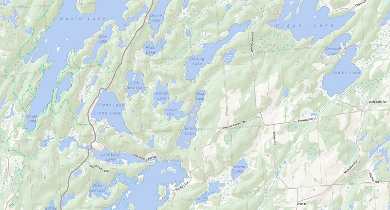
Ontario Satellite & Topographical Maps
The Government of Ontario provides detailed satellite imagery and topographical maps for free which you can export as PDFs. The topographical maps are high quality and show trails you wont find on too many other maps. The high resolution satellite imagery can also help find even more trails! Just be mindful that certain trails may enter private property or might actually permit motorized traffic so some additional research can sometimes be required.
Canadian Topographical Maps
The Government of Canada’s Canada Centre for Mapping and Earth Observation produces topographical maps for every province and territory and are an excellent starting point for exploring beyond Ontario.
Have a great topo map resource for another province? Let us know in the comments!
Ontario Crown Land Map
Ontario also has a fair amount of Crown Land, most of which is available for camping (for up to 21 days in one location). To identify Crown Land, definitely check out the Government of Ontario’s Crown Land Use Policy Atlas. You can camp pretty much in any yellow area. If you do plan to camp, it’s a good practice to print a copy of the specific area and policy you plan to use. If you are travelling during hunting season, be sure to wear a hunter orange cap as a minimum protection.
More on Crown Land camping… There are a few established but unmaintained and undocumented Crown Land campsites in Ontario that can only be accessed by foot, bicycle or by 4WD vehicle and are available on a first come, first served basis. A good way to find them is check the Ontario topo map for dead end trails leading to lakes or rivers. If you choose to camp on Crown Land, please do your part and practice Leave No Trace Principles.
U.S. Topographical Trail Maps
Planning a trip to the United States? National Geographic has built an easy to use web interface that allows anyone to quickly find topographical maps in the continental U.S.A. for downloading and printing. These are the same topos that were printed by USGS for decades on giant bus-sized presses but are now available in multi-page PDFs that can be printed just about anywhere.
Software
Two of the most popular (and free) programs are Google Earth and Garmin Basecamp. Google Earth can export files in KML or KMZ formats and Garmin Basecamp can export files in GPX, GDB, CSV, KML and TCX formats. They both have their strengths and weaknesses and there are many tutorials available online explaining how to use them. Need to convert a file format? GPSVisualizer.com and GPX2KML.com are both useful tools to try out!
Apps
Google Maps typically won’t cut it in a wilderness situation but your smartphone has other options that would allow it to function nearly as well as a dedicated GPS device. Search the App Store or Play Store for “topo”, “maps”, or “GPS”. Looking for more apps? Ontario Parks recently published their own list of useful apps for hikers.
Protip: Your smartphone’s GPS should also continue to function in airplane mode which will help you save crucial battery life. Either way, if you’re going out for more than a day or expect to rely on your phone a lot (maybe for videos and photos too), you’ll want to bring an external battery.
Did we miss any good resources? Let us know in the comments!