
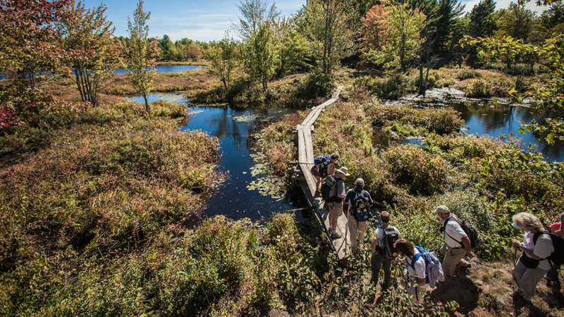
The RTA Kingston Club hiking in Frontenac Pronvincial Park
Looking for a day hike idea a little out of the city? Check out the Rideau Lakes/Westport area for tonnes of options for all types of hikers! This is a preferred area for Rideau Trail members so if you see any on the trails, be sure to say hello!
The most accessible trails are at Foley Mountain Conservation Area in Westport and at Frontenac Provincial Park. Rideau Trail Association volunteers have also built an interesting cable ferry outside Bedford Mills that you may want to see and try.
Foley Mountain has 9km of trails with decent elevations & a great view over Upper Rideau Lake & Westport from Spy Rock. You will see from this map where the Rideau Trail uses the trails here.
Frontenac Provincial Park has about 160km of trails with loop distances from family friendly 1.5km loops to challenging 28km routes. Camping is permitted in this park and visitors can spend a few hours or a few days there. Tip: Rideau Trail members can access the 9km Small Slide Lake Loop via a Rideau Trail path at 6767 Perth Road (Rideau Trail map point 05C) which is a little closer to Kingston than the park’s office. This specific trail is maintained by the Rideau Trail Association in partnership with Ontario Parks.
The Bedford Mills Cable Ferry (Rideau Trail Map 6) was built by Rideau Trail Association volunteers as a means of bypassing a beaver dam. For day hikers, you can do an out & back route from Rideau Trail map point 06D to map point 07A and back to 06D, covering a distance of about 5-6km. 06C to 07A and back to 06C is another option which would be closer to 14km. If you are hiking with a group and arriving in two vehicles, you could drop on off and do a variation (i.e. 06C-07A-06D). North of 07A, the trail uses road for a while which might be less interesting unless you’re working on your End-to-End!
The Cataraqui Trail around Chaffeys Lock is another option. This section of railbed trail is 6km long between Chaffeys Lock Road and Indian Lake Road. You can also walk on Opinicon Road & Chaffeys Road on your way back to make a 12km loop. On this route, you’d pass by Clear Lake which is beautiful (just watch for poison ivy along the trail). You’d also walk over the Iron Bridge just upstream from Chaffeys. If you wanted, you could stop at the Opinicon for ice cream or lunch. Along the road, you’d cross over Chaffeys Lock which is part of the Rideau Canal and you could stop at the old Chaffeys cemetery where Rideau Canal builders are buried. For a 19km linear route (two car shuttle required), you can hike from Indian Lake Road to Forfar. There’s a cheese factory in Forfar that is a popular stop for people traveling through the area.
If this information is helpful to you, we encourage you to become a member of the Rideau Trail Association. Since 1971, the Rideau Trail Association has established, maintained and encouraged low-impact, self-propelled use of the Rideau Trail, a 387 km network of interconnected hiking trails between the City of Kingston and the City of Ottawa located in the general area of the Rideau Canal and its tributary waters.
Always be sure to check out our calendar of outings organized by our local clubs to see if there might be a group hike that might appeal to you. These outings are open to members and non-members alike!
Have any other ideas for hikes in the area? Let us know in the comments!