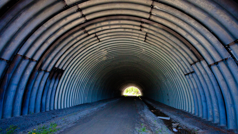
The Rideau Trail/K&P Trail travels beneath Hwy 401 in Kingston by way of this large culvert.
Do you live in or visiting Kingston and looking for a quick adventure? Here are a few options in town.
The K&P Trail is a nice, well maintained rail-bed trail within Kingston’s city limits which starts on the Rideau Trail map point 01E and heads out of town. This is a linear route so unless you can shuttle two vehicles, you will have to retrace your steps. Hiking to map point 02B (Burbrook Road) and back covers about 8km and should take an hour or two. For a change of scenery on the way back, take the Blue Silvers Hill Loop (see map 01p & map 02). On this stretch of the trail, you will also pass below Hwy 401 by way of a giant culvert which is interesting. Note that if the weather is nice, this trail will be pretty busy with other walkers, cyclists & dog walkers.
The K&P Trail north of Burbrook Road (i.e. from 3A to 3C) also crosses some interesting wetlands and should be quieter.
Kingston Mills Lockstation is part of the Rideau Canal UNESCO World Heritage Site is about a 15 minute drive from Queens and provides a glimpse into Canada’s days pre-confederation. The lockstation operates from May to October and the 183 year old lock structures demonstrate the height of 19th century engineering at work today. Adding to that, the 45 foot elevation variation across a 200 metre distance makes it a decent climb (there are stairs). At the very bottom, the granite cliffs are also a popular rock climbing spot. Parks Canada has a self-guided walking tour you can read online. Rideau-Info.com is also an excellent source for more information.
Want to travel a bit further? There are many options about 30 minutes north of Kingston:
Frontenac Provincial Park has about 160km of trails with loop distances from family friendly 1.5km loops to challenging 28km routes. Camping is permitted in this park and visitors can spend a few hours or a few days there. Tip: Rideau Trail members can access the 9km Small Slide Lake Loop via a Rideau Trail path at 6767 Perth Road (Rideau Trail map point 05C) which is a little closer to Kingston than the park’s office. This specific trail is maintained by the Rideau Trail Association in partnership with Ontario Parks.
Gould Lake Conservation Area is a popular hiking destination for Rideau Trail members with many interconnected trails that should easily fill your time with some interesting loops. These trails are maintained by the Rideau Trail Association in partnership with the Cataraqui Region Conservation Authority.
Finally, the Cataraqui Trail is another rail-bed trail that the Rideau Trail uses here and there. For an interesting section, start from the small village of Sydenham and head east. You will cross a few old train bridges along this route and get some excellent views of Sydenham Lake. As this is a linear route, you will have to retrace your steps.
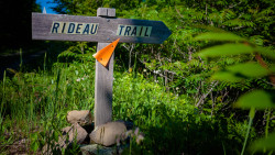
If this information is helpful to you, we encourage you to become a member of the Rideau Trail Association. Since 1971, the Rideau Trail Association has established, maintained and encouraged low-impact, self-propelled use of the Rideau Trail, a 387 km network of interconnected hiking trails between the City of Kingston and the City of Ottawa located in the general area of the Rideau Canal and its tributary waters.
Have any other ideas for hikes in the area? Let us know in the comments!
I would like to know more about the Rideau Trail in the Kingston Area does it continue north of John Counter Blvd I have walked a few sections and would I be able to purchase a map showing more of the routes or where could I go to pick them up. Thank you Del Hume
Hi Del. Of course the trail continues north of John Counter Blvd! The trail is marked all the way to Ottawa. You can download maps for free at the following link: https://www.rideautrail.org/discover-the-trail/wp-content/uploads/2024/04/ Happy hiking!