Views like this are common in Gatineau Park. What’s your favourite trail?
Do you live in or are you visiting Ottawa-Gatineau and looking for a quick adventure? Here are a few options nearby!
Marlborough Forest
Did you know that the Rideau Trail travels through the 3rd largest municipally owned forest in Ontario? The Marlborough Forest is a flat but rugged (and often flooded) conservation area brimming with great hiking options. To stay on the Rideau Trail, stick to the Cedar Grove Trail and the Earth Star Trail. The forest is very wet in the spring (sometimes waist high water) and buggy in the summer. Late summer to late winter are the best times to hike here. Take note that ATVers and hunters typically use some trails in the fall while snowmobiles have access in the winter. If you do hike here, please bring a bag to pack out some trash. You can also make a side trip to the old McKenna School (Being used as a geo-cache location). Check out Map 15 for more detail.
Poets’ Pathway
The Poets’ Pathway is a walking and biking trail of approximately 35 kilometres, much of it on already-existing walking paths through Ottawa. It runs from Britannia Beach, south along Pinecrest Creek, east along Nepean Creek until it crosses the Rideau River and heads north to the Ottawa River, ending in Beechwood Cemetery where the poets lie. The trail is largely unmarked but monuments to Confederation Poets have been installed at various points along the route. Learn more.
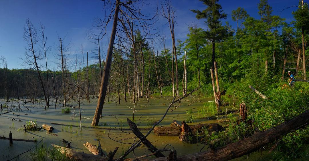
Gatineau Park
Gatineau Park is an excellent spot for a hike through nature. There are over 200km kilometres of trails, with something for all experience levels. Skiing, snowshoeing & fatbiking are popular winter activities and part of the trail system (90 kilometres) is also shared between hikers and mountain bikers. The trail around Pink Lake or to the Wilson Carbide Ruins are among the easier, more popular trails. Advanced hikers might prefer Wolf Trail or the Luskville Falls Trail. If you want a unique challenge, check out the Bad Beaver Ultra, a 150-km stage race through the park. See the Gatineau Park Summer Trails Map for the complete trail system.
Mer Bleue
At Mer Bleue there are 21.7 kilometres of hiking trails. A great hike is the six-kilometre forest trail that goes up to a sandy escarpment that overlooks the bog. The Mer Bleue Bog Trail is a boardwalk that allows you to explore the heart of the bog and discover its many interesting facets.
Kanata South March Highlands
Maintained almost exclusively by the Ottawa Mountain Bike Association, SMA is open to hikers to use as well. What these trails lack in electation gain make up for in technical quality and natural beauty. This trail network is made up of a combination of loops and it can be easy to get lost, so make sure to bring a map or GPS.
Stony Swamp
Stony Swamp has 40.9 kilometres of hiking trails which connect to the Trans Canada Trail and the Rideau Trail. Stony Swamp trails pass through woodlands, an old quarry with unusual geology, beaver ponds, beaver dams and an old lime kiln. This area has a number of distance options and is a great place for families to hike.
Urban Hiking on the Capital Pathway
Ottawa is home to the Capital Pathway network, one of the largest in North America. More than 600 kilometres of multi-use paths link superb natural areas, parks, gardens, museums and attractions. The paths are great for cycling and many other activities such as walking, running and in-line skating. This pathway network links the National Capital Region to the entire country via the 15,000-kilometre Trans Canada Trail. The pathways in the Outaouais are also part of the 4,000-kilometre Route verte network.